Wellington Weekly Fishing Report - 23 March 2023
- Wellington
- 20/03/2023
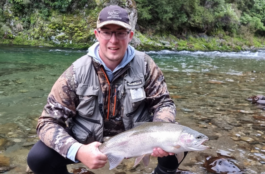
Pictured - Jacob Morison with a stunning Wellington region backcountry rainbow.
Good Weekend To Hit The Water
A relatively settled patch of weather this weekend should see good fishing conditions across most of the lower North Island.
While some of our rivers are still carrying sediment load from rain earlier this week, many are running high with plenty of autumn flow but are still clear.
The Hutt and Otaki are a case in point. Both have got three-times their normal flow but are fishable today, and as they drop further the angling should only improve over the weekend.
Trout are actively feeding all day as they try to put on condition ahead of the looming spawning season. And despite the recent cooler temperatures, anglers report fish still taking off the surface.
Despite what has been a very wet season with frequently flooded rivers, there's still plenty of angling action to come - so make sure you get amongst it when the weather is right.
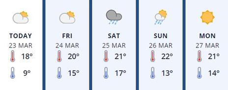
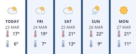
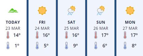
Here's the outlook for the weekend:
Hutt River and tributaries
Click here for live weather updates.
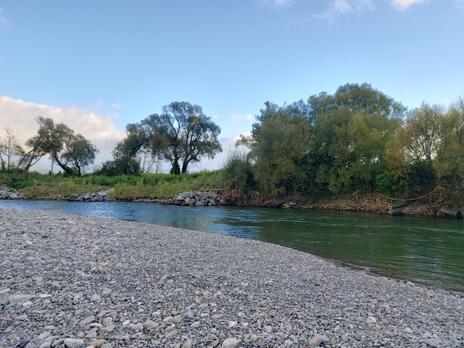
The Hutt, Akatarawa, Pakarutahi and Whakatikei are all high but clear and fishable at time of writing. The fishing will improve as the rivers drop further, but if you're in for a cast today think spinners or large streamers which should be ideal given the higher flows at present.
The Hutt River at Totara Park this morning (Credit: Al Markham)
Kapiti Coast
Click here for live weather updates.
There are good flows in all the Kapiti Coast rivers after the rain earlier in the week. However, the Waikanae, Ohau and Otaki rivers are all clear and fishable today, and with only a few showers forecast for Saturday river conditions will only improve over the weekend.
The Otaki River at SH1 this morning (Credit: Phil Teal)
Wairarapa
Click here for live weather updates.
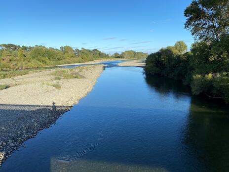
The Waiohine, Waingawa and Tauherenikau are carrying extra flow but are just becoming fishable this morning and will continue to improve over the coming days. The extra water from the main tribs is affecting the Ruamahanga which is carrying colour though it may be suitable for spinning or flinging streamers come the weekend.
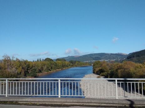
The Waiohine River at SH2 this morning (Credit: Hamish Carnachan)
Manawatu
Click here for live weather updates.
The Manawatu River is carrying plenty of colour and flow south of the gorge. The sediment load is coming from the Oroua and Pohangina, after the damage these catchments suffered during Cyclone Gabrielle - they're likely to be a long time recovering. However, upstream of the gorge anglers should find some fishable water and it's also time to start looking at the smaller spawning tributaries where trout will start to congregate.
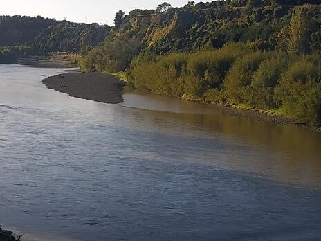 The Manawatu River at Teachers College this morning (Credit: Horizons)
Rangitikei
Click here for live weather updates.
It's a tale of two rivers for the Rangitikei River - at least two parts of the river. The middle and lower reaches continue to be plagued by sediment coming in from the Kawhatau and Whakarekou. Meanwhile, upstream around Springvale and Mangaohane the river is in great shape and absolutely loaded with fish, potentially fleeing the dirty water downstream.
The Rangitikei River at Pukeokahu this morning (Credit: Horizons)
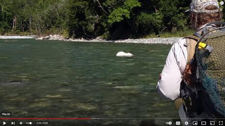
Video Of The Week
The team at Catch Magazine do a super job with their print production, and the video below shows they're pretty slick with visual media too!
Click the screenshot below to watch some mouth watering action from the South Island.
Tip Of The Week - Fishing Fishable Water
Let’s face it – it has been a challenging and frustrating season. Record rainfall, cyclones and weather bombs have made finding fishable water tough at times.
However, there are resources to help. Following details how Fish & Game staff use various websites and data for working out if we can drift dive sites/reaches or not. We need at least 3m of underwater visibility which, topside, will give you plenty for spotting fish.
- Webcams - Horizons has dedicated website for webcams for some – not all – rivers in the region. The main catchments are covered so, even if the water you are interested in fishing isn’t shown, you can still get a good idea of fishability by looking at images for neighbouring rivers.
The most useful for fishing are:
Manawatu (Weber Rd and Hopelands)
Mangawhero (Pakihi Rd near Ohakune/Raetahi)
Oroua (Almadale reserve between Fielding and Cheltenam)
Rangitikei (Pukeokahu – east of Taihape and Mangaweka)
These images are refreshed every few minutes so are up-to-date. If you can see the riverbed through the water it is likely fishable. Have a look around on this site clicking on the different pic to see rivers where you are looking to go. - River Height & Rainfall
Both Horizons and Greater Wellington regional councils have live river data available offering an incredible gateway to some really useful information.
From this Horizons webpage you can either zoom in on the map, or type the river you're looking to fish into the field at the top left hand corner.
GWRC's environment data website is very similar. Use the 'Select site' field to pick your river, then 'Select measurement' field to find either 'flow' or 'stage' - flow being the volume of water passing the gauge and stage being the river height.
You will be presented with a line graph which clearly shows whether the river is up or down.
Turbidity is also a useful measurement - roughly equating to how clear the river is running. High values mean dirty, lower values cleaner.
Note – you can change the amount of data using the interval (we normally use 7 days or 1 month). Fort longer periods you can make out low flow levels where the river is likely fishable.
Over time you'll get better at making assessments about fishability based on the data presented. - Weather Websites
Our go-to weather forecasts are Metservice, YR, and Windy.
This is more predictive rather than actual data, however, cumulative rainfall can be helpful once you know your catchment and it's ability to assimilate rainfall.
Have a play around using these sites to assess your favourite fishing spots - it becomes more intuitive the more you use the site. In no time you'll be an adept amateur weather and fishing forecaster.
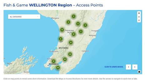
Angler Access - Your One Stop Shop
Click the map below and visit the one-stop shop for all your angling access information.
Noticeboard
- Treble Hooks - New regulations for the 2022-23 season ban the use of treble hooks on waterways where there are maximum size limits on trout i.e., fish over a certain size must be returned. These rivers are identified in Note 3 on page 39 of the regulations book. This measure was adopted by the Wellington Fish & Game Council to help the survival of large fish, the breeding specimens, when released after being caught. Please consult the Wellington section of the regulations guide, particularly Note 5 which details where trebles are permitted. All other waters only single hooks are allowed.
- Wellington Fish & Game has been advised of the following dates for flushing flows from the Moawhango Dam:
25 Apr, 21:00-02:00
- River Bulldozing - Don't get an unwelcome surprise by Greater Wellington Regional Council's river bulldozing ruining your day on the river. The upcoming activity schedule can be found here.
If you have any information you'd like to have considered for addition to the notice board, please get in touch with us.
*This report was accurate at time of writing. For your safety please ensure you check the latest weather and river flow information before you head out on the water.