OPUATIA WILDLIFE MANAGEMENT RESERVE
Shallow willow and scrub dominated floodplain. This is often covered in water spilling over from the Opuatia Stream and the nearby Waikato River. However, it can also be bone dry some years. Doc permit required.
Access Points
- Waikato River
Opuatia River negotiable by boat from Waikato River (see Waikato River access points). - Churchill Road
Foot access to DoC Wildlife Reserve by two access strips off Churchill Road. DoC permit required.
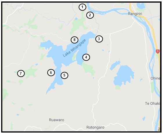
LAKE WHANGAPE WILDLIFE MANAGEMENT RESERVE
Large Waikato Lake (1450 hectares of open water) and adjacent wetlands (910 hectares). Popular area with Canada geese. A DoC permit is required. - Whangape Domain
Boat ramp at public domain provides access to lake via Whangape Stream. Domain located at lake's outlet off Glen Murray-Rangiriri Road also provides foot access to many possies. Hunters camp in the domain and either walk south-east edge of the lake to find a possie or boat out to the western end. Note: Boaties beware of rock weir to protect lake levels. Shuggs Landing is a better boat launch site. Note: access road and boat ramps poorly maintained. - Beverlands Road
Access also possible from Beverlands Road. Access across unformed legal road to lake edge reserve. Note: may not be suitable to launch boat in low water periods. - Herbert Road
Access across private land. Landowner permission required. - Slater Road
Access across private land. Landowner permission required. - Awaroa Swamp/Stream
Most practical access to stream across private land. - Shuggs Landing
Off Glen Murray Road has good off-road parking and is a preferred boat launch site. There is no boat ramp and 4wd is recommended to launch boats at this location especially when the lake is low.