SELECT HERE TO VIEW - MAP OF THE TARANAKI RINGPLAIN
Select link below to go directly to information
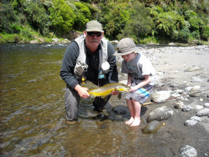
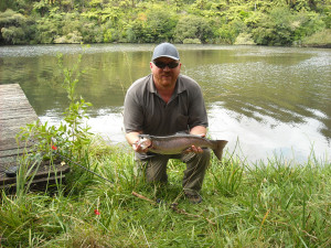
Waiwhakaiho River
Lake Rotomanu
Lake Mangamahoe
Waiongana and Mangaoraka Streams
Lower Waitara River
Lake Ngangana
Stony (Hangatahua) River
Manganui River
Maketawa Stream
Lake Ratapiko
Upper Patea River
Lake Rotorangi
Lower Patea River
Waingongoro River
Kaupokonui Stream
Opunake Lake
Waiaua River
Waiwhakaiho River
New Plymouth’s closest river is best fished in its upper reaches upstream of Lake Mangamahoe, or in the lower river below the outlet of Mangorei power station.
The Waiwhakaiho is subject to very rapid rises in river level following heavy rainfall on Taranaki Maunga – so please check rainfall and river flows here (https://www.trc.govt.nz/environment/maps-and-data/regional-overview/), before going fishing.
In the lower river, generation from the Mangorei power station can result in a 20cm rise in water level and an increase in flow from around two m3/s to nine m3/s, so care should be taken when crossing as you could end up stranded on the wrong side of the river.
Access to the upper river is through farmland off Alfred or Egmont Roads (landowner permission required), or bridge crossings at Peters Road and SH3 (Egmont Village).
At SH3 park on the New Plymouth side of the bridge heading east towards Egmont Village where there is a rough track down the bank to the river.
Further downstream there is walking access via Plantation Road and the Mangapouri Cemetery. Park away from the cemetery gates and walk through to find a gravel track that leads down to the river.
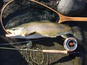
The upper river is characterised by good water quality, bouldery riffles, runs and pocket-water with moderately-sized pools and large brown trout.
Anglers generally use nymphs such as a stonefly imitation (long shank #12 with 3 mm tungsten bead) or coloburiscus pattern (medium shank #12 with 2.8 mm tungsten bead) or small hare & copper or pheasant tail nymphs cast to sighted fish on their feeding lies.
A small nymph suspended under a bushy dry fly is also a good technique to explore the runs and pocket-water with.
Fish can also be targeted with a dry fly or by swinging a caddis pupae imitation (wee wets) during the evening rise and in January and February, the use of cicada patterns will also take fish.
Public access to the lower river is from Constance Street off Devon Road (SH3) and also Rimu Street, Merrilands Domain and William Street, which are all off Mangorei Road.
At the end of Constance Street, off Devon Road just north of the Waiwhakaiho SH3 Bridge, park on the road verge by the track over the stop-bank.
This gives access to several pools, this area is open all year but fishes best in the early season when it can provide good dry fly fishing in the evenings as the water begins to warm up and stimulate aquatic insect life.

At Rimu Street, head right at the fork in the road and walk along the track at the end of the road, which gives access to a number of good pools. The white, yellow and black landmark pole at the end of the track marks the upstream limit for all year fishing.
Merrilands Domain (Audrey Gale Reserve) also provides good access to several large, deep pools, although this area is popular with swimmers in summer. Drive in via the sealed access road next to the sports field. There is plenty of parking and toilet facilities are available but be mindful that the road access gate is locked in the evenings.
At the end of William Street, park by the gate away from driveways and walk down the track which gives access to a series of pools and runs around the river bend.
Further upstream, the river can also be accessed at Burgess Park on Junction Road SH3 east of the Mangorei Road intersection.
A favoured spot is the run and pool immediately downstream of the Mangorei Stream confluence.
A kilometre further upstream, Waiwhakaiho Road off SH3 gives access to the “power-house pool”, which is where the discharge from Mangorei power station enters the river. Over the years, some very large brown trout have been caught in this pool.
There is a public picnic area adjacent to the carpark.
The 6km reach upstream from the powerhouse pool to the Mangorei hydro scheme diversion weir is subject to a 400 – 700 l/s residual flow regime during low flow periods and supports just the occasional fish.
Early season bait fishing with a creeper or worm suspended under a bubble float is effective in the lower river, which typically fishes well in the mornings before the power station discharge begins, or in the evenings when generation ramps down.
Spin fishing in the deeper runs and pools in this reach using a veltic or 7g black & gold toby can also be productive.
Fly fishing with a #12-14 pheasant tail nymph or green caddis imitation suspended under a bushy dry fly indicator is a proven technique including swinging the fly down and across into the run and pool tails.
It’s harder to spot trout on their feeding lies in the lower river and going prospecting in the pools, ripples and runs is a good option.
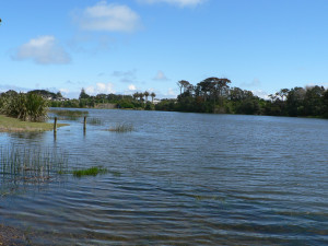
Lake Rotomanu
Located near the Waiwhakaiho River mouth in New Plymouth, this fishery is periodically stocked with takeable rainbow trout by Taranaki Fish & Game, including for a family trout fishing day in late October each year.
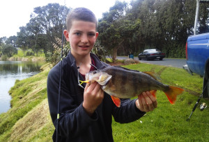
The lake also holds good-sized perch up to 1.5 kg which makes this an ideal place for junior anglers and those being introduced to the sport.
Anglers have easy access to the entire lake margin.
Proceed east along Devon Street East, through the lights at Fitzroy and into Clemow Road, which leads to the lake.
All methods are effective, with the “bubble float and worm” being popular. Small coloured soft-baits are also effective for perch, particularly in spring when fish are in spawning condition.
Lake Mangamahoe
Located midway between New Plymouth and Inglewood on SH3, Lake Mangamahoe is the region’s most popular lake fishery, holding brown trout up to 2.6 kg and rainbows up to 2.25kg.
Around 300 adipose fin-clipped hatchery rainbows are released annually to maintain the rainbow fishery.
Trout often cruise the lake margin in shallow water and a number of bays provide good fishing.
Lake Mangamahoe is designated fly-fishing only.
Created in 1933 to provide water for the Mangorei hydro scheme, the lake also serves as the water supply for New Plymouth and is a Wildlife Refuge.
Owing to these uses, boats are not permitted to be used on the lake.
To access the lake turn off SH3 opposite the Kent Road intersection and follow the gravel road that runs along the western shoreline.
Walking access to the Waiwhakaiho inlet and points along the eastern shore is also available by taking the walking track beginning at the swing bridge at the southern end of the lake (hilly) or by parking at the Plantation Road mountain bike entrance just east of Lake Mangamahoe and walking down the gravel forestry road and then taking the second track on the left.
The lake has good water quality and clarity, which allows for a wide variety of fishing styles – from setting an ambush with a small nymph, to retrieving a lake fly up over the weed beds
Stalking the lake edge, spotting and casting to feeding fish is a popular technique, as is casting from the fishing platform located along the gravel access road.
Use a floating fly line and imitations of dragon and damsel fly larvae fished with a bit of movement.
The naturals are quite large so a #10 is OK.
However, other effective nymph patterns such as hare and copper, pheasant tails and variants need to be around #12, #14 or even smaller and fished very slowly for best results.
On a windy day the ripple in the drift can provide sufficient movement.
Water boatman are present in large numbers but they are tiny.
Tippets need to be as light as you dare and fluorocarbon if the budget allows.
Lake Mangamahoe trout are not avid risers to dries, but in the height of summer will sometimes take a cicada.
They do however take a lot of emergers from just under the surface, so it pays to have a selection of these in the fly box - small and sparsely tied in varied colours.
Fished on the drift to a feeding fish, they can be very effective.
If no surface activity is apparent, or if the urge takes you, traditional wet or lake fly fishing with a full sinking, or sink tip line and a #4 or smaller lure style fly is also a useful technique.
There are a multitude of flies to use; marabou, fuzzy wuzzy, rabbits, hairy dog, Mrs Simpson, parsons glory, red setters, to name but a few, and all will catch fish.
Cast out as far as possible, let the line sink, then retrieve so as to give the fly some movement.
The intention is to imitate larger trout food items ranging from dragon and damsel fly larvae to bullies.
Quite often the strike will occur as the fly is entering or lifting over the weed beds towards the end of the retrieve.
Most of the trout food items in Lake Mangamahoe are green/olive, brown or black, so flies in these shades will perform consistently.
However, trout are fickle creatures and will often prove any theory wrong - hence the effectiveness in the lake of red setter, red fuzzy wuzzy and yellow parsons glory flies.
There are also anglers who have success using bloodworm imitations fished static. So experiment with fly colours, size and retrieval speed if the fishing is slow.
All in all, with its attractive setting and varied fishing opportunities Lake Mangamahoe is definitely worth a visit.
Waiongana and Mangaoraka Streams
Located on SH3 midway between Bell Block and Waitara, the Waiongana and its tributary Mangaoraka Stream contain brown trout averaging 1.5 kg.
Both streams are best fished in their middle and lower reaches.
They can be reached from bridges at Devon Road (SH3), Te Arei Road West (off Ninia Rd) and Manutahi Road.
The Mangaoraka can also be reached from Corbett Road and the lower reaches from Mahoetahi Road off SH3.
The lower Waiongana can be reached by turning off SH3 onto Tate Road and then left into Brown Road.
Landowner permission is generally required as there is little formal public access at these access points, barring a short stretch of esplanade reserve along the Waiongana at Brown Road, and along the true left bank of Mangaoraka Stream above Devon Road SH3.
There is also an esplanade strip along the true right bank of Mangaoraka Stream above the Corbett Road and Manutahi Road Bridges.
On these streams bait fishing with creeper and worm is successful early in the season and after freshes.
Fly fishing with small (#16) hare and copper or halfback nymphs under a bushy dry fly indicator is also effective, as are brown and green beetle imitations (November – January) or dry flies such as the Coch-y-Bondhu (February – April).
The lower reaches of both streams below SH3 Devon Road are open to fishing all year.
Over winter these lower reaches are best fished using gold or tungsten bead head weighted nymphs, toby or rapala spinners, or a worm.
Lower Waitara River
The Waitara River, one of Taranaki’s largest, drains an extensive area of the Taranaki eastern hill country and often carries a high silt load.
However, the lower reaches downstream of the Manganui River confluence clear during low flow periods and can provide good fishing for brown trout, particularly in spring before the water gets too warm.
Owing to the size of the river and its turbidity, spin fishing is the most productive method.
The lower river can be accessed through farmland off Mamaku, Spargo and Manganui roads (permission required).
Lake Ngangana
Located next to the Taranaki Kart Club track at the end of Joll Street, Waitara, this 4ha lake is periodically stocked with rainbow trout.
It also has a good population of perch.
There is a walking track along the adjacent Waitara Riverbank that gives access to some fishing sites.
Lake Ngangana is open all year to fly, spin and bait fishing. Aquatic weed growth can be an issue at times.
Turn east into Princess Street off SH3 just north of the Waitara River Bridge and take the first right into Joll Street.
The southern end of the lake can be reached from Waipapa Road, but please park on the road edge away from the gate.
Stony (Hangatahua) River
Located near Okato in coastal Taranaki, the Hangatahua (Stony) River often has the best water quality of any ringplain fishery and in 1985 was the first New Zealand river to be granted a Local Water Conservation Notice.
However periodically over its history, the trout fishery has been decimated by sand and ash from rain-induced erosion events on Taranaki Maunga.
These events have become more frequent in recent years, but in between times the habitat stabilises and the river can hold reasonable numbers of wild and hatchery rainbow trout, plus the occasional brown.
Owing to the “here today – gone tomorrow” nature of the fishery the entire river is open to angling all year round and stocked each year with up to 200 two-year-old rainbows to provide immediate angling opportunities.
If the conditions remain favourable over a longer period these fish make excellent growth and reach a large size.
This is one of very few Taranaki streams where bait fishing is prohibited and while there is a daily bag limit of two rainbow trout, there is currently a zero-bag limit for brown trout to allow the species to re-establish. Most anglers fishing the Hangatahua practise voluntary catch & release in recognition of the fragility of the fishery.
The lower river is reached from the SH45 Bridge, through farmland off lower Kaihihi Road, or through farmland at the end of Brophy Road (landowner permission required).
The middle reaches are accessed via the Stony River walkway off upper Kaihihi Road and from the Mangatete Road Bridge.
The upper river is reached from Wiremu Road bridge (off Saunders Road) or from the top of Saunders or Puniho Roads.
Deleatidium mayflies are the most common invertebrate and dry fly fishing or using a weighted nymph though the deeper pools is recommended.
As a consequence of the regular erosion events this fishery can be very up and down, however when it is settled the combination of large prime trout in clear water makes this one of Taranaki’s premier angling experiences.
Manganui River
One of the larger ringplain rivers, the Manganui receives water from several tributaries on the eastern side of Taranaki Maunga and holds moderate numbers of brown trout up to 2.5 kg.
In its middle reaches, a weir diverts much of the Manganui’s flow into the Motukawa hydro scheme and Lake Ratapiko, although a fish pass and downstream residual flow has restored the migratory pathway along the river after a break of 75 years.
The lower Manganui River can be fished from Everett Park (two entrances), Bristol and Tarata Roads, the middle and upper reaches from Tariki, Croydon and Manganui Roads and SH3.
There is public access at Everett Park, but all other access points require landowner permission.
Nymphing (both blind and to sighted fish) and bait fishing with creeper and worm are favoured, although spin fishing in the river downstream of Tarata Road can also be productive.
The river downstream of Bristol Road Bridge is open to angling all year-round.
Maketawa Stream
Located four km south of Inglewood on SH3, this Manganui River tributary has good water quality and holds brown trout up to 2.5 kg.
The stream is reached from the SH3 and Junction Road bridges (difficult) and through farmland (with landowner’s permission) off upper and lower Norfolk Road.
Creeper fishing is effective, but nymphing to sighted fish with small hare and copper, halfback and caddis patterns is the more favoured method on this stream.
Lake Ratapiko
This shallow 21-hectare hydro reservoir is located nine kilometres down Tariki Road, which turns off SH3 midway between Inglewood and Stratford.
Good populations of hatchery rainbows, wild brown trout and perch are present.
Lure anglers often favour small veltic and toby spinners here, while nymph and wetfly fishing are also effective.
Lake Ratapiko is a great place to take youngsters bait fishing for perch.
The water ski and power boat club areas off Tariki Road provide good access to the lake margin.
Permission to fish from other areas should be obtained from the appropriate landowner.
The lake is closed to fishing for the month of May each year for duck hunting.
Upper Patea River
Running through the heart of Stratford, the Patea River is one of the ringplain’s most productive brown trout fisheries.
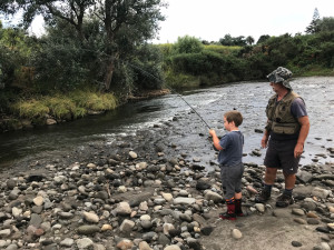
In recent years, rainbow trout have also established in low numbers from releases of hatchery fish for an annual kids’ trout fishing event in King Edward Park in the town centre.
This fishing day is held in early December each year and the trout left over in the river provide ongoing opportunities over the Xmas period, which is ideal for youngsters getting into fishing.
Good fishing is available within Stratford township, though the largest fish are present below Skinner Road.
The upper river is best fished from tracks within King Edward Park and along the Carrington Walkway between Juliet Street and Swansea Road.
The middle reaches are accessed from Skinner Road Bridge and through farmland off Bird, Hungers and Waihapa Roads (landowner permission required).
Local Stratford angler and Fish & Game Ranger, Max Barnard often fishes the Patea River running through Stratford and recommends a careful upstream approach to spot fish and a gentle cast with bead head nymphs, striking at any stoppage or hesitation in the line.
Lake Rotorangi

This scenic hydro lake east of Eltham is 46km long and was created by damming the Patea River in 1984.
The lake contains plenty of perch that grow to 1 kg or more.
Few trout are present in the middle and lower reaches of the lake, but the upper reaches from Glen Nui up to the first river rapid can produce good conditioned browns and rainbows up to 2.25 kg.
Public access to the upper reaches is via Anderson/Rawhitiroa Road at Eltham, which leads 24 km to a good boat ramp at Glen Nui.
The middle reaches are accessed via Tawhiti, Ararata and Tangahoe Valley Roads, which lead to the Pukekino Landing water ski area.
The lower reaches can be accessed via Ball Road off SH3 south of Hawera.
Perch can be caught by trolling with flies or spinners or by jigging or fishing off weedbeds with a worm.
Deep trolling is the preferred method for trout but as noted trout numbers are very low in the lower and mid-reaches of the lake.
Lower Patea River
The lower Patea River flows 43 km from Patea Dam to the sea and is of very low gradient.
Flows are controlled by the operation of the Patea Hydro Electric Power Scheme (Patea HEPS) and fluctuate between a consented minimum of 2.1 m3/s and the maximum station outflow of 75 m3/s, or more if the dam is also spilling.
For the current flow click on https://www.trc.govt.nz/environment/maps-and-data/site-details/?siteID=28&measureID=9 .
Previously the brown trout population was relatively sparse but many of the individual fish were of large size, sometimes in excess of 4.54 kg (10lb).
In more recent years rainbow trout have also been caught below the dam.
From 2017 - 2021, Manawa Energy as part of their operating consents for the Patea HEPS released 1,000 brown trout and 500 rainbow trout fingerlings each spring.
These releases were part of a five-year trial and the fish are individually marked with a coloured floy (spaghetti) tag inserted just under the dorsal fin.
In addition, Fish & Game has also released up to 200 two-year-old rainbow trout each year since 2020. These fish have an adipose fin clip and a deformed dorsal fin from their time in the hatchery.
If you catch one of these fish please report the details (tag colour and year and if possible length, weight and also freeze the stomach for collection) to us at Taranaki Fish & Game.
The river contains many other fish including smelt, perch, grey mullet and the whitebait species, and the diet of trout is very broad comprising fish, aquatic insects, koura (freshwater crayfish) and snails.
Unfortunately, the walkway to access the popular fishing spot at the station outfall has been closed by Manawa Energy for health and safety reasons and it is unlikely to reopen in the foreseeable future.
However, there is still plenty of good access to the 14km of the river between McColl’s Bridge and the dam. The river is most easily fished under low flows which create a series of pools and riffles, but still can fish well at flows up to 25 m3/s.
A characteristic of the river is the large amount of woody debris in the channel.
This is much more obvious at low flows which makes it easier for anglers to fish around these obstructions.
The water is often quite dark and with all the debris and the often large size of the pools means spinning is the much-preferred method.
Another advantage of spin fishing given the previous low density of trout is that more water can be covered than with other angling methods.
Popular lures are all the standard types such as the black toby, daffy, glimmy, z-spinner and cobra variations.
Diving lures such as rapalas also work well but come with the risk of hanging these often expensive lures up on all the debris.
There also appears to be considerable potential to use easily cast soft baits.
Bait fishing with a worm or smelt suspended under a bubble float is also an effective option though noting that there is also a considerable eel population throughout the lower river as well.
Fly fishing is less easy due to the size of the river and steep banks behind which limit casting though the recent development of micro-skagit techniques also overcomes this difficulty.
However, fly fishing is more of an option at low flows when the river is smaller and it is possible to get out on the exposed gravel bars.
Swinging a sunken streamer fly such as yellow rabbit or olive woolly bugger is preferred given all the debris to work around and that fish feature in the diet of these trout.
Much of the river is inaccessible, however, the 14km reach i below the dam is easily accessed from Maben Road which runs between McColl’s Bridge and Lake Rotorangi.
There is public access along both banks, which are open and easy to negotiate and this makes for endless fishing opportunities through this reach.
The landowners are happy for anglers to park on the roadside and walk across the paddocks from Maben Road down to the river, however definitely no firearms and no dogs!
Illegal hunting is a significant issue for the landowners who rightly take a dim view of this.
Maben Road is reached via Ball Road, which runs off SH3 just north of Kakaramea.
Waingongoro River

The Waingongoro is one of the most popular ringplain fisheries and is one of a select group of rivers in the region that support good populations of both brown and rainbow trout.
The Waingongoro has its source on the south-eastern slopes of Mount Taranaki between the Stratford Plateau and Dawson Falls and winds 74 km through productive dairying country to reach the sea at Ohawe, seven km west of Hawera.
Waingongoro means resting or sleeping place and was the name given to the river by Maori from the Aotea canoe of the Great Fleet, who arrived in New Zealand about 1350 AD and made their way overland to settle in South Taranaki.
Today, the river flows through the rohe (traditional tribal area) of the Ngati Ruanui and Nga Ruahine Iwi.
In its upper reaches, the Waingongoro is a clear mountain stream, but downstream of Eltham the river increases in size, taking on a tannin stain and adopting an extensive meander pattern that produces many deep pools and runs.
Pasture and willows predominate along the river channel, though the river retains some of its original cover of native vegetation on its scenic bush-clad bluffs.
The Waingongoro is a moderate-sized river in its middle and lower reaches, with a median flow of five m3/s and a summer low flow of 1.3 m3/s at the SH45 Bridge.
An abundance of caddis insect life ensures that both trout species grow into good, conditioned fish of 1.5 kg or more and the Waingongoro supports the ringplain’s most productive rainbow trout fishery, which is great for beginners.
Trout distribution along the Waingongoro is strongly influenced by the location of four concrete weirs, which currently prevent trout from moving upstream.
Few trout are present in the headwaters of the Waingongoro above a pair of disused hydro generation weirs located on the Cardiff Walkway, 600 metres above Opunake Road.
Only brown trout are present in the 17 km reach of river from the Cardiff weirs down to a 3-metre weir at Riverland’s abattoir, located 800 metres below Eltham Road.
Both brown and rainbow trout are present in the remaining 43 km of the river down to the sea, though trout in the lower 17 km are currently unable to move upstream past the 5.5 metre Normanby weir, located between the Normanby and Mawhitiwhiti Road Bridges.
The upper reaches in the vicinity of Opunake Road are fairly small and support roughly one large brown trout per pool.

Trout numbers increase further downstream as the river increases in size and up to 20 medium and large brown trout per kilometre are present in the river adjacent to Eltham.
Fish can be well educated and a careful approach is required.
Recommended fly fishing patterns include #12-16 pheasant tail and hare and copper nymphs, brown and green beetle (in season) and deer’s hair caddis for the evening rise.
Mayfly hatches also occur in this part of the river.
Bait fishing with creeper or worm is effective in the larger pools near Eltham, particularly early in the season and on the tail of freshes.
The middle and lower reaches of the Waingongoro between Eltham and the sea are usually tannin stained, but trout can still be spotted on their feeding lies in front of boulders, in the tail of the pools or cruising in the pools and back-eddies.
The river carries a good flow in spring and early season bait and spin fishing is productive.
For novice anglers, a fly, creeper (dobsonfly larva) or worm suspended under a bubble float will often bring success.
Adjust the length of trace to suit the depth of water so that the fly or bait is near the bottom.
Spinners, such as black and gold tobys, z-spinners, veltics and rapalas are also effective, even during low flow periods.
Nymph and dry fly fishing come into their own as the river falls toward its summer low flow and trout move into the shallow aerated riffles.
Un-beaded or gold/tungsten-bead hare and copper, pheasant tail and halfback nymphs in sizes 12 to 16 are popular choices.
Dry fly fishing with brown and green beetle can produce exciting daytime fishing to rising fish from late October through to mid-summer, with bushy dry flies (#12-16) also working well as the water warms up.
Fishing the evening rise with a deer hair caddis and trailing wee wet fly floated downstream and swung to rising fish is also a proven technique to produce some exciting action.
Schools of adult smelt frequent the river below Normanby weir in late summer and swinging a smelt fly on a floating or slow sinking flyline is also an effective approach at this time.
While there is legal public access to some parts of the Waingongoro via formed and unformed public roads and a scattering of esplanade reserves, marginal strips and recreation reserves, the vast majority of land bordering the river is in private ownership and landowner permission should generally be obtained before going fishing.
Details of some of the major access points on the river include;
- Opunake Road Bridge: In Stratford, turn west off SH3 into Celia Street, which becomes Opunake Road and drive 5 km to the Waingongoro Bridge. Anglers can also reach this access point by turning off SH3 into Climie Road, 3km south of Stratford. Park on the western side of the bridge near the Cardiff walkway sign and take the picnic area track down to the river. Fish 600m upstream to the concrete hydro weirs (built in 1918 and 1933) and walk back downstream via the Cardiff walkway, which winds through riparian bush and farmland up to a lookout. To fish the river downstream of the bridge, anglers must obtain permission from the landholder at 608 Climie Road. The Waingongoro is quite small in this area and while trout numbers are low, the wily browns present in the larger pools provide a real challenge for the angler.
- Finnerty Road and Cornwall Road provide access to the river off SH3 between Stratford and Eltham. Obtain permission to access the river from the landowners at 258 Finnerty Road, or 152 Cornwall Road.
- Taumata Park: In the centre of Eltham, turn off SH3 into Bridge Street and head west over the railway line. Turn right into Preston Street and park in the designated area outside the Park entrance. Go in through the gate, turn left and head down past the cricket nets to a dirt track, which leads to the river. Anglers can either wade upstream from here or follow a rough track up the riverbank, which ends about 1km upstream.
- Pinney Drive off Eltham Road: In the centre of Eltham, turn off SH3 into Bridge Street (which becomes Eltham Road) and head west over the railway line. Before reaching the Eltham Road Bridge over the Waingongoro, turn right into Pinney Drive. Head left over the bridge and park on the grassy area next to the corrugated iron building. Walk back to the Pinney Road Bridge. The narrow paddocks next to Eltham Road are road reserve and provide access for upstream wading, or downstream to the Eltham Road Bridge pool. Please take care to shut gates securely, avoid disturbing stock and keep to the river channel. Anglers can fish upstream from here to Taumata Park.
- Lower Stuart Road off Eltham Road: In the centre of Eltham, turn off SH3 into Bridge Street, head west for 2.5km and turn left into lower Stuart Road. Permission to access the river must be obtained from the landholder at 205 lower Stuart Road, which is on the left near the road end.
- Skeet Road Bridge: Turn off SH3 into Skeet Road, 7km south of Eltham and drive 2km along to the Waingongoro Bridge. Park on the road verge away from gates.
- Onewhaia Road: Turn off SH3 onto Te Roti Road, 3km north of Normanby and then left onto Onewhaia Road. Obtain permission from the road-end landholder. Access can be quite difficult in this section, owing to steep banks and relatively deep crossings and it is best fished during the summer low flow. Avoid the quarry.
- Mawhitiwhiti Road Bridge: Turn off SH3 into Mawhitiwhiti Road at Normanby and drive 3km to the Waingongoro River Bridge. Park on the western side in the grassy area by the power pole adjacent to the road. Walkthrough the pipe gate upstream of the bridge and fish upstream. This popular section has some excellent pool, riffle and run sequences, but watch out for the bulls! Cross over before the deep corner pool about 1km above the bridge for access to an extensive area of fishable water upstream.
- Normanby Road Bridge: The 1.5km reach upstream of Normanby Road Bridge to the Normanby weir is one of the most popular on the river, but anglers must get permission from the landholder at 155 Normanby Road (house on the left immediately downstream of the bridge). Turn off SH3 into Mawhitiwhiti Road at Normanby and turn left into Normanby Road after 2.5km. Park on the eastern (Normanby) side of the bridge on the right-hand side away from the gate.
- Downstream of SH45: Park on the eastern (Hawera) side of the SH45 Bridge facing west. Walk over the old bridge and down through the old quarry site (staying away from the cut faces) to a pipe gate in the fence at the downstream end of the quarry. Go through the gate and walk downstream through the pasture to the farm bridge. Anglers can either fish back up to the quarry or cross the bridge and go further downstream, which gives access to a large river loop. This is relatively big water with deep pools and runs that are ideal for spin and bait fishing. Short bouldery riffles provide areas of interest for the flyfisher.
- Ohawe Reserve: The Waingongoro River mouth and lower pools can be reached via Ohawe Beach Reserve, which is at the end of Rangatapu Street in Ohawe township. Turn off Surf Highway 45 into Ohawe Road, about 4km west of Hawera. Once in Ohawe, keep heading left until you see Rangatapu Street. Park near the boat club and walk into the river through the reserve. River crossing is required to fish upstream to SH45. The section of river downstream of SH45 is open to angling all year.
Kaupokonui Stream
Located five km west of Manaia, the Kaupokonui Stream and its largest tributary Mangawhero Stream both contain good-sized brown trout.
In recent years a population of good-sized rainbow trout has also become established.
The Kaupokonui Stream is fished either from bridge crossings at Eltham, Skeet and Upper Glenn Roads and SH45, or through farmland off Manaia Road (landowner permission required). The lower river can also be reached from Lower Glenn Road and Kaupokonui Heads Road, which brings one to a campground adjacent to the estuary. Anglers can walk upstream from there to access some good pools and runs. The lower Kaupokonui from the sea to SH45 is open to fishing all year round.
The Mangawhero Stream is best fished above and below the Skeet Road Bridge, by crossing the Kaupokonui a short distance upstream of SH45, or through farmland off Upper Glenn or Rama Roads (landowner permission required).
Nymph, dry fly, or bait fishing with creeper and worm are recommended.
Spin fishing is also popular in the lower Kaupokonui downstream of the Mangawhero confluence.
Opunake Lake
The lake is reached by a short walk down a track on the Opunake side of the SH45 Bridge, or via Domett or Layard Streets in Opunake.
Fishing with a wetfly, spinner, or bait where the inlet race meets the lake is a good spot, as is fishing from the shore by the boat ramp.
In recent years sand ingress from the Waiaua River has created an extensive delta at the head of the lake.
Note - Currently the lake is unfishable and releases of rainbow trout will not resume until the power scheme is fully back up and running.
Waiaua River
Located at the eastern entrance to Opunake, the Waiaua has been subject to periodic inundation with sand and ash from headwater erosion events since the diversion of the unstable Oaonui Stream headwaters into the catchment during a series of major floods in 1998.
Much like the Hangatahua (Stony) River, the Waiaua has some reasonable periods of stability in between events and the trout fishery is fortunate to receive recruitment from several smaller tributaries that are unaffected by erosion.
A concrete weir at SH45 diverts water into Opunake Lake for the Opunake hydro scheme, leaving a residual flow of around 250 l/s in the short stretch of river between SH45 and the coast.
The Waiaua supports a modest population of wild brown trout, plus a few rainbows that are mostly hatchery fish originating from releases into Opunake Lake. A significant erosion event in July 2021 all but wiped out the fishery and to aid its recovery bait fishing has been banned and there is a zero bag limit for brown trout and a 1 fish limit for rainbows.
The lower river downstream of SH45 is open to angling all year.
Angler access is via the SH45 and Wiremu Road Bridges or through farmland off Ihaia and Kaweora Roads (landowner permission required).